![]()
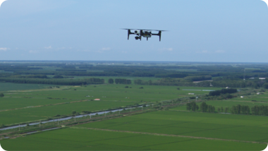
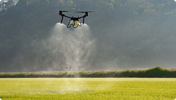
XAG M500 Remote Sensing Drone is designed for precision agriculture, with the capability to fly autonomously and capture high definition images with high-performance data processing. Partnering with XAG M500, you can better understand your farm to enable timely and effective actions.
Vision to Digital Farmland
Map precise
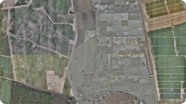
The XAG M500 can help build a digital map of your farmlands, in which each plot and each crop has its own coordinate that allows precise operation of autonomous drones and robots.
Scout effortless
The XAG M500 can fly autonomously at high-frequency to capture overall farmland images. Without getting their feet on the ground, farmers can master every change of their fields with ease and take timely measures.
Grow smart
By taking advantage of third-party AI software, the XAG M500 can help you gain insight into plant growth and identify crop abnormity. Decisions are made with science to enable variable- rate spraying and fertilization.

Lõi thông minh đến Agrifuture
SuperX 4 Pro, Hệ thống Điều khiển Thông minh do XAG tự phát triển, được trang bị khả năng đa tác vụ để mang lại cho XAG M500 sức mạnh của chuyến bay hoàn toàn tự động ở độ chính xác cấp cm. Khâu hình ảnh theo thời gian thực cho phép tạo bản đồ ngay sau khi hạ cánh.
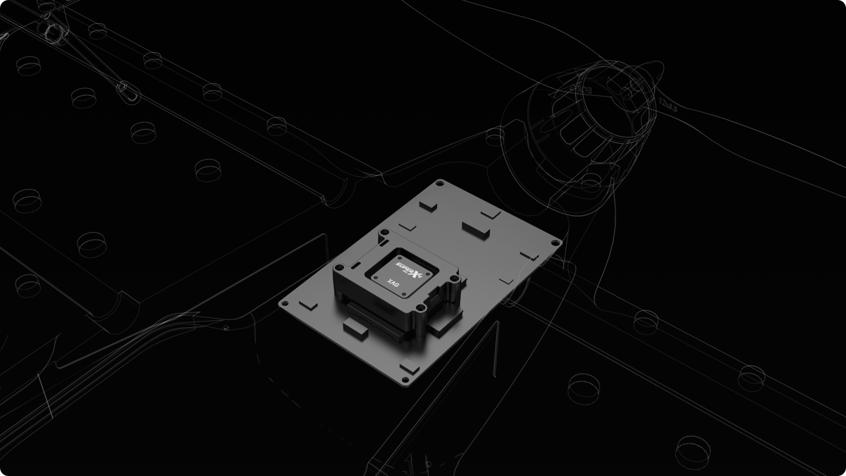
CM-level Positioning
Dual-antenna RTK + portable base station
Enhanced Flight Safety
AI fault prediction + emergency protection mechanism
30-hectare Real-time Image Stitching
6-core CPUs + NPU
Seeing the Unseen
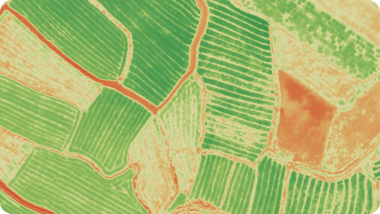
Four switchable cameras can capture multi-dimensional data from field overview to crops growth status. Reveal hidden but valuable information to help manage your farm with lower operation cost.
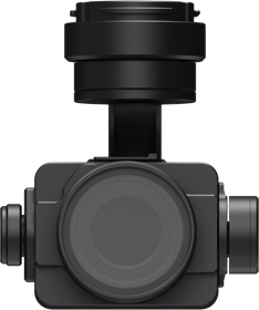
XCam 20MP Pro Gimbal Camera¹
Used for Orthophoto & Oblique Photography |
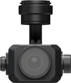
XCam 26MP APS-C Gimbal Camera²
Used for Orthophoto & Oblique Photography |
|
|
|
|
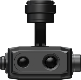
XCam 20H Hybrid Gimbal Camera³
Used for HD Map & Thermal Map |
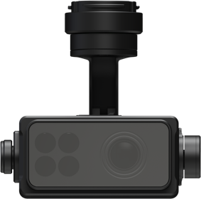
XCam 20M Multispectral Gimbal Camera⁴
Real-time NDVI Video |
Easy Control With One Screen
XAG SRC1 Smart Remote Controller, with its built-in touchscreen and XPilot APP, allows freely switch between autonomous flight and manual control. Multiple flight planning modes are available to meet your needs of various application scenarios. The 4G and Wi-Fi dual communication system support stable and long-range internet connection.
XPilot APP⁵
Easy flight planning
4G + Wi-Fi Dual Link
Stable signal & image transmission
5.5" 800 Lumens HD Touchscreen
Clear visual under strong light
4.5h Duration⁶
Suitable for longer task

Field Mapping
HD map

Oblique Photography
3D map

POI Cruising
Target areas scouting

Strip Mapping
River & roadway inspection
Mapping Your Farm into Precision Agriculture
 |
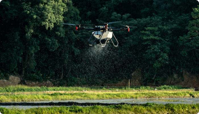
Weeds Control PracticesThe XAG M500 can be used for weed detection on crops, with the weed zone identified and located via the third-party AI software. Then a prescription map will be sent to the XAG agricultural drones for variable-rate spraying that can remove weeds with less pesticide use. |
Fertilization ManagementThe XAG M500 can collect crop growth data and produce digital field maps to be analysed by the AI software. The AI prescription map will be generated and guide the XAG agricultural drone to spread fertilizers on where necessary. Improve yields with reduced fertilizers. |
 |
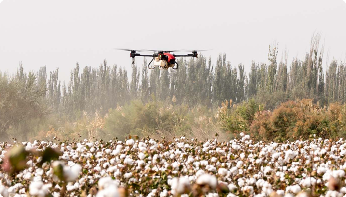 |
Cotton Boll Opening ControlThe XAG M500 can create an HD cotton field map where the immature boll opening can be discovered and tagged. When receiving the labeled map, the XAG agricultural drones will conduct defoliation on target zones to facilitate large-scale mechanical harvesting. |
Note:
1. 2. 3. 4. Four cameras all featured: mechanical shutter max out at 1/2000s, 3-Axis gimbal, auto distortion correction, maximum 512 GB sd card supported.
2.Equipped with this camera, the M500 can capture 5 images at different angles rapidly before next vertical shoot, which is almost 5 times faster than traditional oblique photography when
other parameters are the same.
5. xml file is supported for different applications.
6. The specific performance may vary depending on the working environment, temperature, user habits, etc. Please use strictly in accordance with the official product guidelines.
Ready to buy